
Walk a Windham Street Record
A useful street-by-street search separates ownership, recorded transactions, permits, voter registration, and historical occupancy. Start with the legal Town of Windham parcel even when the mailing line says Willimantic, North Windham, South Windham, or Windham Center. The assessor and GIS identify a current parcel and owner of record. They do not identify every person who lives there. SearchIQS then supplies the recorded instrument trail, while permits and dated directories add building and occupancy clues.
The sequence below keeps one record from being mistaken for another. Save the source date and exact address spelling at every step. If a portal returns nothing, shorten the street name, remove its suffix, and check whether the postal label differs from the municipality.
- Open the Windham Assessor route and search AxisGIS by number and street. Record the parcel ID, situs address, owner, mailing address, and card date.
- Browse the same segment in AxisGIS. Select each relevant parcel rather than treating a map label as a person record.
- Use the owner name in SearchIQS. Follow the current grantee backward through earlier grantors, dates, and book/page references.
- Check PermitLink by parcel or location. Keep applicants, contractors, owners, and occupants as separate roles.
- Use voter and historical directory evidence only as dated corroboration. Neither source is a live household roster.
This Windham street directory method produces a reproducible chain: address to parcel, parcel to recorded owner, owner to deed, then date-specific supporting records. It is stronger than a single name match and leaves room for a certified Town Clerk copy when an image or index is unclear.
Search Windham Streets in AxisGIS
The Windham Assessor page links to the current AxisGIS parcel viewer. Search by owner, address, or parcel ID. Address data is entered by people, so suffix and abbreviation changes matter. A search for a road may work after dropping “Road,” “Street,” or “Avenue.” Selecting a result zooms to the parcel and opens details that may include assessment data, a property card, and document links.
| Search control | Input | Street-directory use |
|---|---|---|
| Owner | Last name first; add first name if supported | Find candidate owner parcels, subject to spelling |
| Address | Number and street; vary the suffix | Locate situs parcel candidates |
| Parcel ID | Town format and zero padding | Bridge the card, permit, and deed trail |
| Parcel result | Select the result or pushpin | Open map, details, assessment, and links |
| Report | Select a parcel and report option | Save dated output if enabled for Windham |
| Mailing labels | Select parcels or abutters | Parcel mailing output, not an occupant list |
The official AxisGIS help describes Identify, layers, reports, abutters, and map-print tools, but each town enables its own set. Confirm what the live Windham viewer shows before promising a layer or export. Date the map and parcel details because ownership and assessments can change.
The linked Assessor screen shows where Windham directs a current property search.
View the Windham Assessor and GIS access page before opening the parcel viewer.
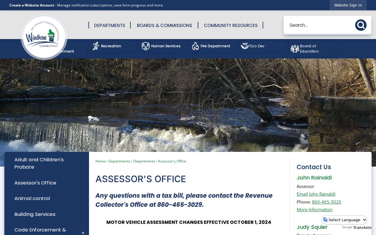
That page is the municipal starting point; the selected parcel and its date remain the facts to preserve.
Read a Windham Parcel Card
A Windham parcel card distinguishes the property location from the owner’s mailing address. It can also show account, map, and GIS identifiers, utilities, zoning or neighborhood fields, appraised and assessed values, prior assessments, and ownership history. Those keys make the card useful even when a name is common. The card’s print date and assessment period are essential, since neither proves current title or occupancy.
- Parcel
- A mapped unit of land identified by the town for assessment and record linking.
- Situs address
- The physical location of the parcel, which can differ from the owner’s mailing address.
- Plat
- A recorded map showing parcels, lots, boundaries, roads, or related survey information.
- Criss-cross directory
- A directory arranged by street and house number instead of only by surname.
The assessor card bridges the street directory to SearchIQS, tax records, and permits. An entity, estate, or trust may appear as owner, and an out-of-town mailing address may be valid. Report those fields by their actual labels. Do not turn “owner” into “resident.”
Trace Windham Deeds by Street
The Windham SearchIQS entry offers guest access to the Town Clerk’s land-record index. Its Windham coverage page lists online land-record index data and images from November 24, 1965 forward, grantor/grantee index books from 1706 through 1977, and record books beginning in 1687 through the 1965 boundary. Maps are listed from 2012 as index data. Exact image availability varies.
Start with the current owner as grantee. Then search that person or entity as grantor and grantee, keeping document type, recording date, book/page, instrument number, and image status. “Grantor” is the party conveying an interest; “grantee” receives it. Mortgages, releases, easements, liens, maps, and probate transfers are distinct instruments, not substitutes for a deed.
Search controls include Party 1 and Party 2, From and Thru dates, document group and description, book/page, instrument number, case number, partial names, and a party-type option. If the modern index fails, use Index Books, choose a volume, enter a surname, and open the cited page. Some entries have no image. The Windham Town Clerk controls originals and certified copies when a signature, legal description, or missing scan matters.
Record depth. Windham’s searchable layers cross modern land records and index or record books reaching into the seventeenth and eighteenth centuries, but coverage does not mean every image is online.
Windham Street Records Compared
No single public record supplies a complete Windham household list. The reliable approach compares address-keyed sources and preserves what each field actually means. Windham County has no current county recorder, assessor, or county seat because Connecticut county government ended in 1960. Local land and assessment questions belong with the Town Clerk and Town Assessor, not a nonexistent county office.
| Source | Address key | What it shows | Access or limit |
|---|---|---|---|
| AxisGIS and Assessor | Situs address or parcel ID | Owner, mailing address, map, assessment, card links | Public viewer; owner is not occupant |
| Town Clerk and SearchIQS | Party, book/page, instrument | Recorded deeds, liens, maps, and trade names | Guest index; Clerk supplies official copies |
| PermitLink | Parcel or location | Permit type, owner or applicant, dates, status, work | Public list; older completeness unstated |
| Civil property search | Town, partial street, ZIP | Public case and docket lead | Judicial display limits apply |
| Historical directory or news | Dated street and number | Past name, business, or notice | Publication date only |
| Voter system | Name and town | Registration and polling jurisdiction | Not an open street roster |
The table also shows why a whole-street result takes work. Parcel IDs connect modern systems, while a person’s name and a historical address connect older indexes. A dated, labeled record table is more honest than merging every name into one undifferentiated street directory.
Windham Permits Follow Addresses
Windham Building Services directs users to PermitLink. The public permit list exposes parcel ID, owner, record number, location, permit number, type, issue date, fees, status, and work description. Some rows also offer inspection, parcel, or print controls. A permit can tie a project to an address, but an applicant or contractor is not automatically a resident.
Review the current Windham public permit table and its filters before drawing a conclusion from a blank search.
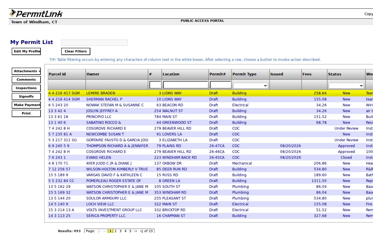
The captured headings show the roles and dates that should be recorded separately in an address research log.
Published coverage is not stated. For an older permit, inspection, or code file, contact Building Services with the exact address, record type, and date range. Windham also provides a local Freedom of Information request route when a defined public record is not in the portal. A missing row proves only that the query found no displayed match.
Windham Voters Are Not Street Lists
The Windham Registrars of Voters link to Connecticut’s individual lookup, but that lookup is oriented to a person and town, not to every occupant on a road. Town, last name, first name, and date of birth are used to confirm a registration record, party, and polling location. A similar name elsewhere in Windham County is not a Town of Windham match.
See the Windham registrar contacts and official voter links for the current local route.
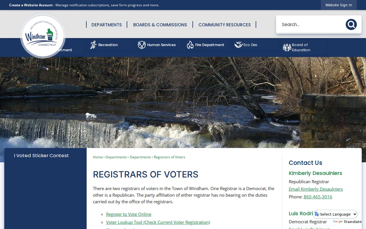
The page supplies official contact and aggregate election context, not a public row-by-row street roster.
Connecticut’s centralized voter-file request is a separate, paid CSV process with limited permitted uses and privacy rules. Protected voters may be absent from released address data. Property ownership also does not prove registration at the parcel. For lawful personal research, use an individual lookup only to confirm the person and jurisdiction already under review.
Note: Record the lookup date because registration status can change, and never infer that a missing voter means an address is vacant.
Willimantic Labels Change the Search
Windham’s address geography has three key layers: town, former city, and postal label. Willimantic kept separate city government until its July 1, 1983 consolidation with Windham. Older directories may therefore say City of Willimantic, while current parcels belong to the Town of Windham. North Windham, South Windham, and Windham Center are local districts or sections, not separate Connecticut municipalities.
Postal wording can create another mismatch. A mailing label routes delivery and does not settle a municipal boundary. Near North Windham, a 06235 routing clue may point toward Chaplin, so verify the address through USPS and then confirm the municipal parcel. Current sources did not expose a complete official list of renamed or renumbered Windham streets. For one disputed location, compare recorded maps, assessor data, Sanborn maps, Town Clerk instruments, and the exact publication year.
This is Windham’s most practical address quirk. Preserve the old place label instead of silently modernizing it. Then map that label to today’s parcel. A failed exact-name search may reflect the era or postal form, not the absence of a record.
Historical Windham Streets by Number
Digital Windham’s 1938–1939 Price & Lee directory covers Willimantic, Windham, and Coventry, including citizen, street, business, map, civic, church, and school sections. Its transportation exhibit also cites 1909–1910 directory entries at exact Lewiston, Jackson, and Main Street addresses. Those examples show how a dated street entry can connect a name or business to one number.
The Library of Congress address-directory guide identifies a Willimantic 1984–1985 criss-cross lead, though its exact local holding and page run still require confirmation. Read these sources as year, street, number, then name. Verify the page or scan, and pair it with a map or deed. For deeper coverage of the historical shelf, use the Windham city directory collections rather than treating one old volume as a current address source.
Sanborn maps for Willimantic are listed for several years from 1887 through 1924. They add building footprint and use, not occupants. A strong historical street table keeps the map year, directory year, printed number, person or business category, modern parcel match, and confidence level in separate columns.
Build a Windham Street Directory
A research log prevents false joins. Give each parcel one row, then keep the parcel ID, situs, mailing address, owner, deed citation, permit record, voter evidence, and historical entry in their own fields. Include a source date and confidence note. This structure makes disagreements visible rather than smoothing them away.
The best key is often the parcel ID, not the street spelling. It bridges the current GIS, card, and permit record. Owner names then bridge to the deed index. Historical directories use a printed number and name, so they need a dated map before being attached to a current parcel.
When a desired record is offline, use the complete fallback chain: contact the Windham Assessor for parcel questions, the Town Clerk for recorded instruments and certified copies, Building Services for older permit files, and the local FOI form for a defined public record. ECSU, Willimantic Library, and the Connecticut State Library handle older directory, newspaper, map, and town-document gaps.
Limits of Windham Street Records
A Windham street directory cannot supply a complete list of people inside a building. Assessor cards name owners and mailing recipients, not every occupant. Deeds show recorded interests and transfers. Permits show project roles. Voter records have purpose and privacy limits. Utility, delivery, DMV, protected voter, Address Confidentiality Program, sealed court, juvenile, and private roster data do not form a public street layer.
Use exact labels such as “owner of record,” “permit applicant,” “registered voter on the lookup date,” or “name printed at this address in the 1938 directory.” Stop when the source cannot support a stronger claim. That rule is especially important for trusts, estates, multi-unit parcels, and an owner whose mailing address is elsewhere.
Lawful use. Use Windham address records only for lawful personal, family-history, property, or civic research. Never use them to stalk, harass, intimidate, or expose a protected person.
A portal result is a lead, not permission to contact or target someone. Confirm important facts with the office that holds the record, and respect confidentiality or redaction signals without trying to work around them.